USER STORY
Asset Management of the National Property Portfolio
ALCM is a technology consultancy focused on providing integrated solutions for the management of assets throughout their life cycle. We develop solutions that allow for effective management of assets based on informatics that provide accurate real views of actual operating environments.
Challenge
- Spatial enablement of an integrated facilities and infrastructure management solution
Solution
- Using Esri Technology
Benefits
- Visual presentation of asset data
- Improved user efficiency
- Enhanced asset management
The Challenge
The project team did not encounter any challenges with the integration. However, in our implementation we had to ensure that the asset data received from the client, such as the GPS co-ordinates, were accurate and in the correct format.
Background
The National Department of Public Works and Infrastructure (NDPWI) is the custodian of Immovable Assets comprising of approximately 35 000 land parcels, which are either vacant or improved, and 110 000 buildings. The NDPWI is responsible for the Immovable Asset Register and for maintaining and reporting on the assets.
The project
The NDPWI appointed ALCM to implement an integrated facilities and infrastructure management solution to assist with the improvement of its service delivery and efficiencies. The department required the ability to maintain and report on the assets contained and managed within the Immovable Asset Register. The scope of the project included the integration of Esri’s ArcGIS solution with Archibus in order to have a view of the entire asset register. The integration of the GIS data and Archibus allowed the asset portfolio to be displayed spatially using the latest and most accurate information.
The Solution
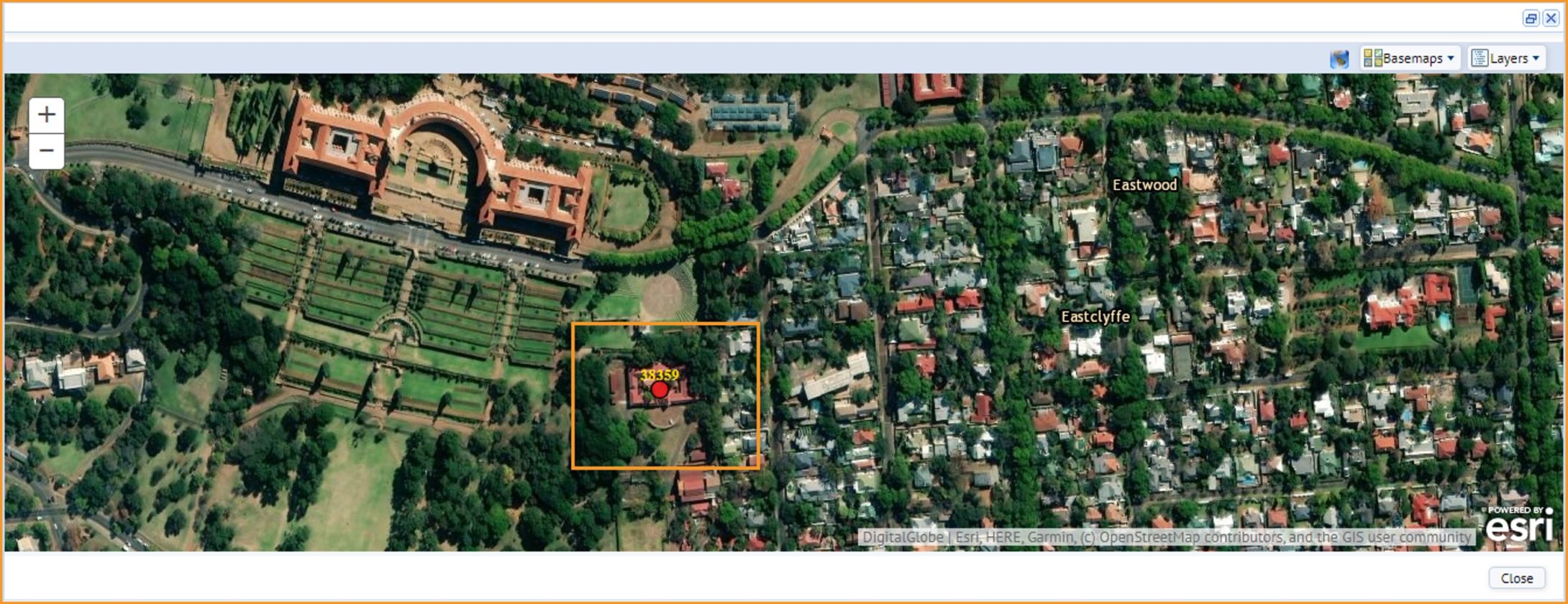
The ArcGIS solution is used to spatially represent the asset portfolio in the form of points or polygons denoting the actual land parcel shape and the buildings that are situated on these land parcels. Users are able to use different base maps to view assets in different locations.
The ArcGIS modules are used by the client in various ways:
- Real Estate Portfolio Management: The NDPWI Portfolio Managers, Real Estate Directors and Lease Administrators use this module to view and examine assets in the portfolio on a geospatially-enabled map.
- Asset Module: The NDPWI REIRS branch uses the platform to identify all assets owned by NDPWI as part of their asset verification exercises.
- Building Operation: Facility Managers, Maintenance Managers and Building Managers use the platform to view the locations of logged service requests.
Conclusion
The ArcGIS integration provides users with enhanced presentation of asset data as well as improved dashboard view reports. Features, such as automated zoom in functionality to each asset and the ability to download immediate reports, has enhanced user efficiency.
Fig. 1: The ArcGIS platform identifies assets with a marker. Users have the option of zooming in or out of the map. Additional identifying information, such as Building Codes, can be accessed using tool tips. Information pop-up windows also provide summary information specific to the asset.

