USER STORY
Communication Regulatory Authority of Namibia
CRAN is the Communications Regulatory Authority of Namibia. Its responsibilities include regulating telecommunication services and networks, broadcasting services, postal services and the use and allocation of radio spectrum.
CRAN appointed Geocarta Namibia, the sub-distributors for Esri South Africa in Namibia, to develop a set of GIS tools, to enable CRAN to visualise and monitor the coverage provided by communication (mobile, radio, fibre) operators.
The team approached the project using the following workflow:

Geoprocessing tools developed:
Combine and Simplify Coverage
This tool allows for multiple feature classes of the same geometry type to be supplied as an input and dissolved into a continuous coverage. Additional geoprocessing operations at this stage optimise the inputs for the apportionment process prior to running the Model Coverage Per Enumeration Area (EA) Zone tool.
Model Coverage per EA Zone
Using the output of the Combine and Simplify Coverage tool, this model calculates the number of people covered and not covered per enumeration area for a given service type. The results can also be presented in an accompanying summary table which can be aggregated to an appropriate geographic level. The output of this model are used in the interpretation stage of the GAP analysis for the provider being investigated.
This tool calculates whether someone in a specific area can receive a specific radio station based on its radio footprint or if their mobile carrier has coverage for the area in question and goes so far as quantifying an approximation of how many people this directly affects
The Challenge
The initial challenge the team faced was the lack of up-to-date data and accompanying metadata. In order to build a meaningful geodatabase, data from various sources in several formats were combined. An important component was to ensure skills development and knowledge transfer. This formed part of a week-long customised training course.
The Solution
The solution included customised training as well as designing and building the geoprocessing models to produce a GAP analysis report.
Outcome
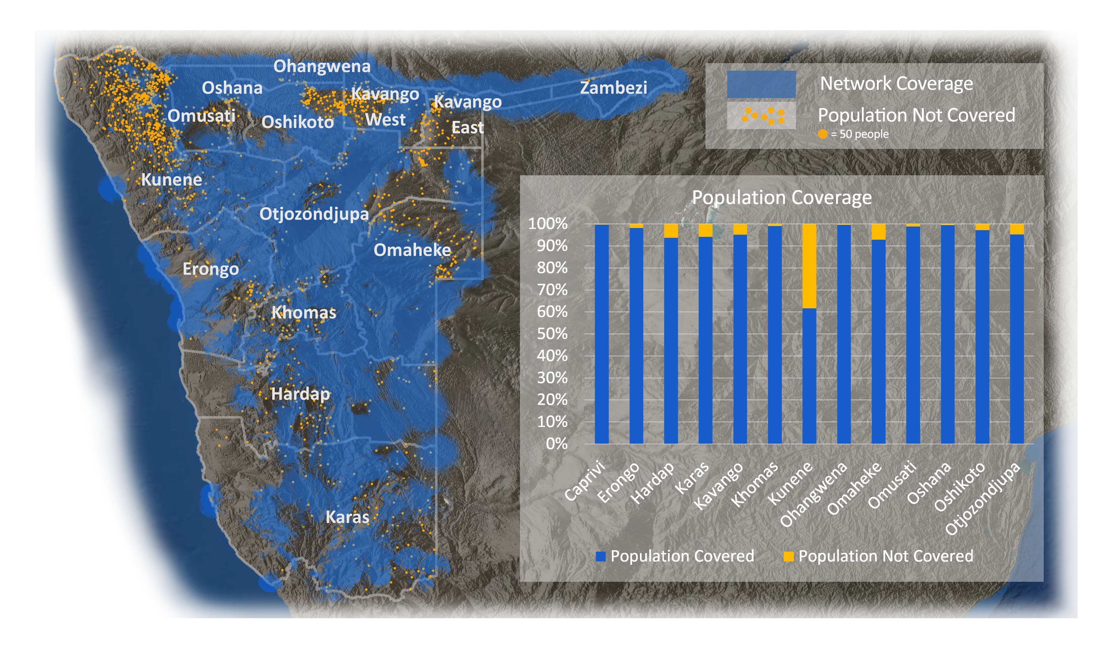
The following serves as a sample of the results provided to the client. The figures in the accompanying graph are calculated using a simplistic apportionment model that assumes population is distributed evenly throughout each enumeration area. MTC is considered the largest player in the mobile space in Nambia.

