USER STORY
African Centre for Migration & Society (ACMS)
The African Centre for Migration & Society (ACMS) is Africa’s leading scholarly institution for research and teaching on human mobility. Established in 1993, ACMS is an independent, interdisciplinary and internationally engaged institution focusing on the relationships among human movement politics, poverty, and social transformation. While oriented towards southern Africa, the Centre conducts collaborative scholarly and policy-oriented work across sub-Saharan Africa and has partnerships in Asia, Europe and the Americas.
It offers Africa’s only post-graduate degrees in migration and displacement studies and provides training to students and professionals on a number of topics including the sociology of migration, mobility and health, human rights, and research methods. While maintaining its scholarly independence, the Centre regularly partners with organisations in government and civil society in identifying data needs, conducting research and shaping policy.
Challenge
- Identify Hot Spots
- Detect change over time
Solution
ArcGIS Pro Desktop and ArcGIS Online
Benefits
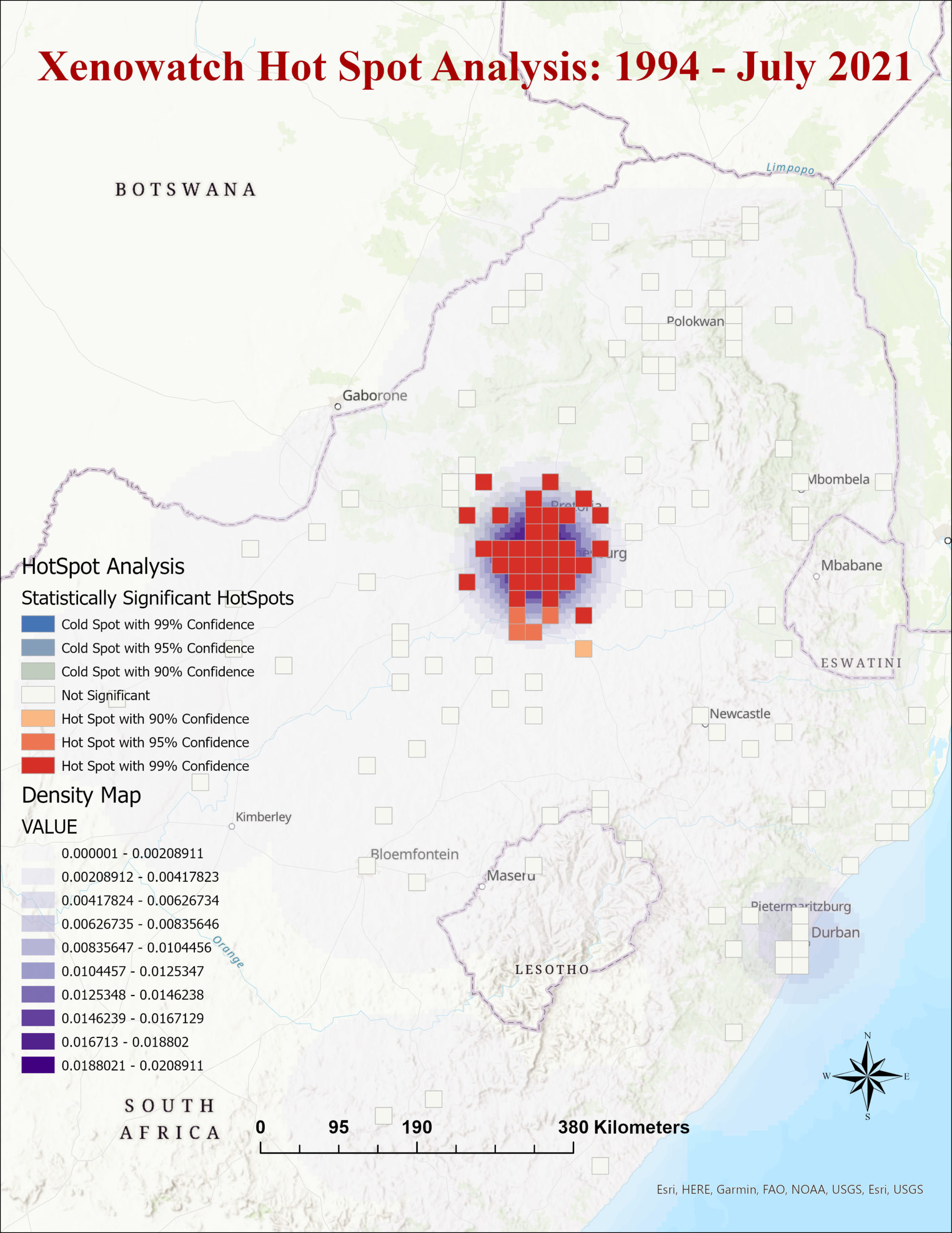
ArcGIS Pro identifies statistically significant spatial clusters of hot spots to determine geographical clusters
Project Background
Developed by the ACMS at the University of the Witwatersrand, Xenowatch is an open-source system for information collection, visualization and interactive mapping that allows crowdsourcing of information and data on xenophobic discrimination incidents in South Africa using the following reporting methods: Free SMS, Email, WhatsApp, Xenowatch App and Website – www.xenowatch.ac.za.
Xenowatch tracks, verifies, records and analyses all forms of xenophobic discrimination (including threats thereof) as well as responses or interventions by all relevant stakeholders including government and civil society. It serves as an early warning system that notifies authorities and civil society about xenophobic discrimination incidents and calls for immediate and appropriate response. Xenowatch data is analysed to identify xenophobia causal factors and characteristics of communities at risk in ways that can inform conflict prevention and resolution initiatives.
The Challenge
Previous research indicates that location and time are important in comprehending conflict and violence. The Xenowatch team needed to not only identify xenophobic violence hotspots, but also determine where these hotspots had worsened over time. The team also required a solution for automatically linking violence data with other demographic datasets in order to connect these disparate datasets in a spatial context.
The Solution
To gain a better understanding of the role of specific locations and provide reliable information to relevant stakeholders, the research team used ArcGIS Pro to identify spatial patterns of violent events and how these patterns change over space and time, while considering the social, economic, and political context. Hot Spot Analysis was specifically used to determine geographical clusters of violent events. When combined with traditional statistical analysis, mapping location data provides a more complete understanding of the causal factors and variability in violence rates across the country.
For more information contact:

