USER STORY
ArcGIS technology supports security guard patrol monitoring
The Challenge
Monitoring, storing and analysing data pertaining to patrols carried out by security guards. Define interchangeable routes for security guards
The Solution
Survey123 form that includes an individual sign-in. Location proximity verification. ArcGIS Online real-time web map and dashboard that displays key metrics
Who is Geo Lens- Data Solutions
Geo Lens- Data Solutions (GLDS) is a geospatial data company that specialises in monitoring of solutions and data collection across various sectors. GLDS has a proven track record for running successful data collection and management projects across Africa relying on the Esri suite of products to capture, store and present clients’ data visually and in real-time, empowering them to measure and manage their businesses more effectively.
Who is First Quantum Minerals
First Quantum Minerals (FQM) is a global copper company and have inventories of nickel, gold and cobalt in mines throughout several countries and employ approximately 20,000 people world-wide. After 25 years of operations, they are now one of the world’s top 10 copper producers, exporting millions of tonnes of concentrate. They are focused on providing a tangible benefit for investors, employees and the many communities that host their operations.
The Challenge
FQM, located in Kalumbila, Zambia, needed a solution to effectively monitor, store and analyse data pertaining to patrols carried out by their security guards. Guards patrol interchangeable routes on a shift basis to protect certain key assets.

The Solution
GLDS broke the challenge into two aspects; the first to solve the monitoring of guard movements and the second to easily collate, store and present the collected data in a format that was meaningful to FQM.
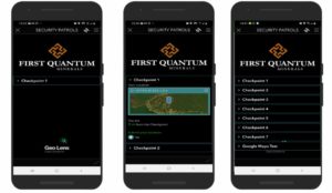
Survey123 was utilised for the guard movement monitoring. A survey form was generated that allowed each guard to sign-in when coming on shift. The guard’s bio-data is captured from a pre-populated pull data sheet. As part of a patrol there are a number of set checkpoints along the route which have to be visited. The GPS locations of these checkpoints were established and stored in a pull data sheet. A calculation in Survey123 was added, measuring the distance between a guard’s actual GPS location and the next checkpoint on the route. A constraint was set that only allowed the guard to submit verification that he/she visited a checkpoint if they were within 5m of the checkpoints known location (accounting for reasonable mobile device GPS accuracy). Only after successfully verifying that a checkpoint has been visited does the next checkpoint appear in the survey form.
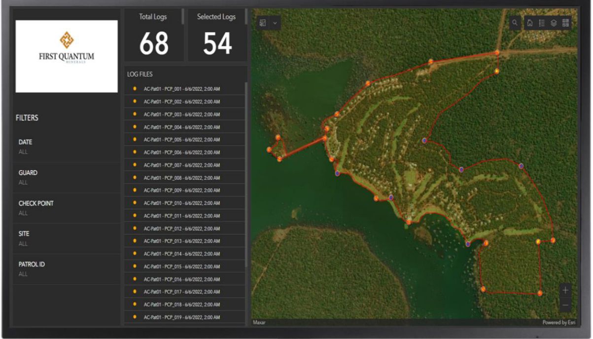
ArcGIS Online was utilised to create a web map and dashboard to contain and represent the captured data. The dashboard showed key metrics as well as a real-time updated map. At a glance FQM can see that all checkpoints on a guard’s route were indeed visited as well as the amount of time it took to move between checkpoints.


