USER STORY
Leveraging Esri technology to validate training centres
Using Esri technology to validate training centres for unemployed youth.
The Challenge
Validating potential host sites for the recruitment and training of unemployed youth through surveys
The Solution
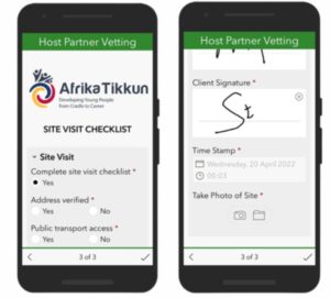
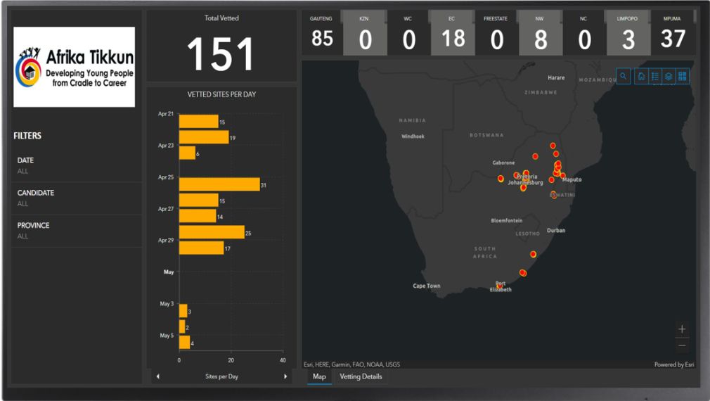
A Survey123 form that includes location, pictures and approval signatures. An ArcGIS Online real-time Webmap and Dashboard that displays key metrics as well as pictures taken at each vetted site
Who is Geo Lens- Data Solutions
Geo Lens- Data Solutions (GLDS) is a geospatial data company that specialises in monitoring of solutions and data collection across various sectors. GLDS has a proven track record for running successful data collection and management projects across Africa relying on the Esri suite of products to capture, store and present clients’ data visually and in real-time, empowering them to measure and manage their businesses more effectively.
Who is Afrika Tikkun Services
Afrika Tikkun Services (Pty) Ltd (ATS) was established with the belief that every young person deserves the opportunity to realise their potential. Their goal is to create an economically thriving South African society by investing in our youth. ATS is an Exempt Micro Enterprise, which became operational in 2013 and is a Level 2 Broad-Based Black Economic Empowerment advisory, recruitment, training and placement company. They provide B-BBEE advisory services and skills training, which supports clients with achieving full integration of youth employability solutions.
The Challenge
ATS needed a solution to assist them with the vetting of potential host sites throughout all of South Africa’s nine provinces specifically targeting rural areas. Host sites are used to recruit and train candidates from the surrounding community so that they can be deployed by ATS into the labour force as required by their clients. Successful host sites are selected by ATS according to strict criteria and were previously captured manually on paper-based questionnaires. This created challenges in terms of collating the data from the completed questionnaires.

The Solution
GLDS broke the challenge into two aspects; the first to solve the data collection challenge and the second to easily collate and present the collected data in a format that was meaningful to ATS.
Survey123 was utilised for the data collection. A survey form was generated in line with the criteria ATS required from their interviewers. The interviewer’s bio-data was captured from a pre-populated pull data sheet and the geopoint field was utilised to capture the exact coordinates of each potential host site. The survey also allowed for photos to be included, providing ATS with a view of the inside and outside of sites. Before submitting, the interviewer as well as the host site representative signed the form to acknowledge that both parties were satisfied.
ArcGIS Online was utilised for creating a web map and dashboard to contain and represent the captured data. The dashboard showed key metrics on the performance of the team conducting the interviews as well as a real-time updated map spanning all nine provinces. A details tab was included in the dashboard allowing ATS to see the pictures submitted in the same interface while analysing all other metrics.


