USER STORY
Solar Map for the eThekwini Energy Office
Helping users to assess solar electricity generation potential for themselves
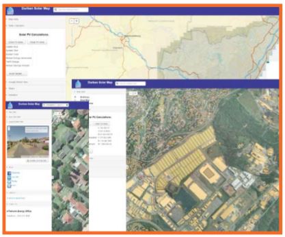
The center-piece of the Durban Solar City Framework is the Durban Solar Map. The Solar Map is a powerful tool to assist potential users of solar energy to determine the potential of solar electricity generation of their roof spaces, and to provide a linkage of potential customers with solar professionals.
The eThekwini Municipality recognized the need for a strategic and coordinated approach to facilitating renewable energy projects in the city. To achieve this, the city has successfully developed the Durban Solar City Framework that focusses on electricity generation through photovoltaic panels.
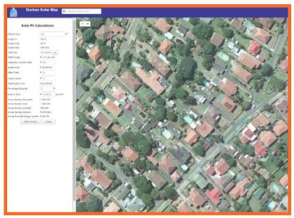
The Durban Solar Map is an interactive and easy to use website that covers the entire eThekwini Municipality area of electricity supply. The website is based on GIS data and aerial photography and permits the users to locate their building, and to quickly and easily obtain an estimate of the solar energy that could be produced by photovoltaic panels on their rooftop along with data on the financial attractiveness of such an investment. Users can search for their address and visually identify their roof. They can then draw the area where they might consider installing photovoltaic panels. This potential installation will then be assessed and basic information will be presented instantaneously to the user. Information including the size of the possible installation, the potential electricity generation per annum, the investment costs and the potential savings.


Further to this a more detailed page is available to allow a user the ability to alter the values used in the calculations giving a more accurate estimation. This will effectively allow the user the ability to see the potential cost savings and estimated potential income from feeding power back into the grid.
In developing the website many factors were considered such as: Simplicity of use, web technology options, ease of integration into existing systems and further expansion and maintenance of the system in the future were among the defined criteria. The selection of Esri technology was an easy one given the prevalence of the platform in the municipality and the availability of GIS data in the correct format.
The system utilizes the ArcGIS for Server platform with the latest HTML 5 and JavaScript based technologies combined with the newest data storage mechanisms to deliver a rich user interface with a performance orientated experience to the end user.
