USER STORY
Utilizing Mobile GIS in Alien Invasive Plant Clearing
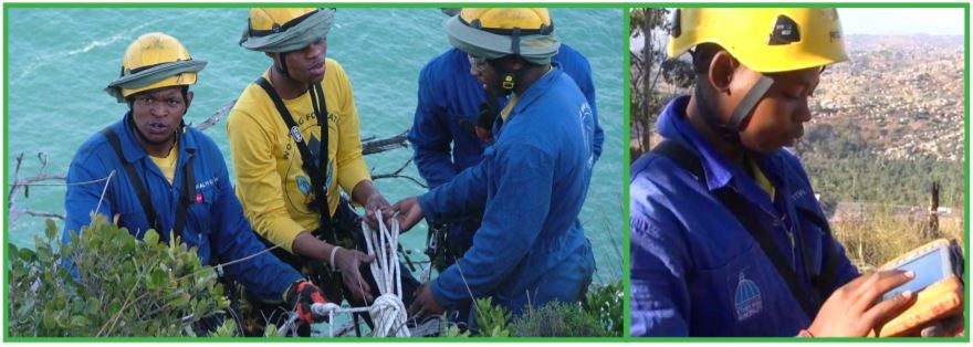
Conceived in 1997, the High-Altitude Teams (HAT) aim to stop the spread of invasive plants species in the upper catchments and precipitous mountain ranges. The organization specialises in the clearing of Invasive Plants species at high altitudes, which means anything from a 35° to a 90° angle on mountains. High-Altitude Team provides work opportunities to more than 400 Rope Access Technicians from previously disadvantaged communities, more than 90% of whom are youth and 30% are women. The organisation has grown to 30 teams deployed in five provinces, namely Limpopo, Mpumalanga, KwaZulu-Natal and Eastern Cape and Western Cape.
Challenge
• Data collection in the field
• Hard drive space
Solution
• Mobile GIS system
• ArcGIS Server for Data storage
Benefits
• Easy integration of Field data in the different provinces.
• Adequate hard drive space for all data collected in different provinces.
The Goal
The main goal of the project is to remove the Invasive Plant Species that are classified as Category 1, Category 2 and Category 3 plants as identified in the CARA Act (Conservation of Agricultural Resources Act). This is done using various techniques and herbicides. High-Altitude Teams, work in conjunction with the Working for Water programme which was specifically implemented to conserve our precious water resources. High-Altitude Teams are mostly focused on mountainous catchment areas because access to these sites is difficult and a high premium is placed on safety. Participants receive specialised training in High Angle Wilderness Rope Access, Wilderness Search and Rescue, health and safety, plant identification and the use of herbicides.
The Challenge
The traditional way that data is collected and updated in the High-Altitude is that GPS coordinates and attributes are collected and taken to a regional office for downloading. This process is primitive and time consuming especially in a very large environment. For that reason, they implemented a Mobile GIS system. Each of the teams has either a Juniper Mesa or a Leica Zeno 5 data logger. The collected information, with attachments, is transferred via the mobile GIS system to an on premise server. Automated backups are completed on a daily basis.

The Solution
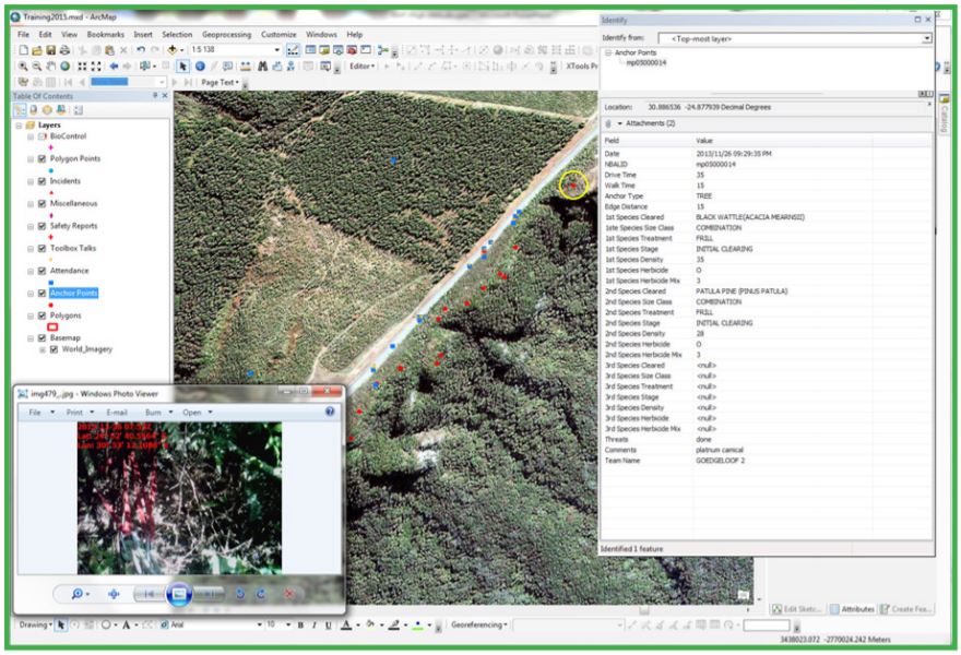
The High-Altitude Teams are currently using ArcGIS for Server Enterprise Advanced 10.3 for the Mobile system. As each team has a mobile device, they upgraded the server to an Esri specified server that can run all the software, has enough hard drive space and have all the machines connected. Working on Fire also obtained a public IP Address in order for their services to be published and the data loggers to connect. If the work is on a flattish area, the crew leader walks around the area and the area is recorded with all attributes. When ropes are used, a coordinate is taken of the Anchor point and the same information is captured for these points. From these anchor points and the distance from the edge, a polygon is drawn to calculate the area to be cleared.
Capturing Anchor Points on ArcGIS

To accurately calculate the slope area, 3D Analyst is used to create an elevation model and to calculate the 3D slope. Spatial analyst is used for planning purposes by creating slope models. The ‘Other’ Benefits The most important asset is the participants that work on the project. All were unemployed before; there are single parent households, single breadwinner households, etc. With the skills acquired in the project, these families’ lives are changed forever. The Department of Environmental Affairs’ Environmental Programmes such as Working for Water, Working on Fire and the High – Altitude Team contribute significantly to protecting the environmental while creating work opportunities under the Expanded Public Works Programme. For more information visit www.environment.gov.za or www.workingonfire.org
